Initial idea:
This project began with the idea of translating a city through personal experience rather than geography. When thinking about London as a whole, I realised that my relationship to the city is not built from an objective understanding of its layout, but from a series of personal landmarks: pubs, streets, tube stations, and small routines that only make sense to me. In that sense, the London I navigate is already a kind of translation.
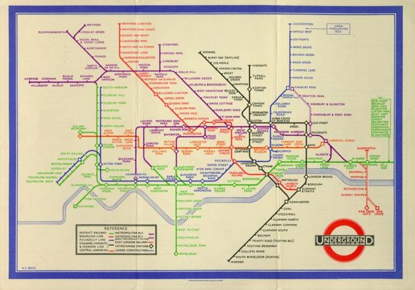
This led me to think about maps. At first, I considered working with a map of London itself. However, the more I reflected on it, the more I realised that the Transport for London map already performs a form of translation. Designed by Harry Beck in 1933, the map does not attempt to represent the geography of London accurately. Instead, it simplifies the network into a diagram inspired by electrical circuits, prioritising clarity and legibility over spatial accuracy. Beck famously argued that a map does not need to be geographically correct as long as it makes sense to the user.
This idea resonated strongly with my thinking. If the TfL map is already a translated version of the city, could it be translated again to reflect individual experience?
I began thinking about how different people navigate London through their own mental maps. Places become renamed, routes become habitual, and certain stations carry personal meanings that are invisible to others. After speaking with friends and people close to me, I realised that each of us carries a slightly different version of the same city.
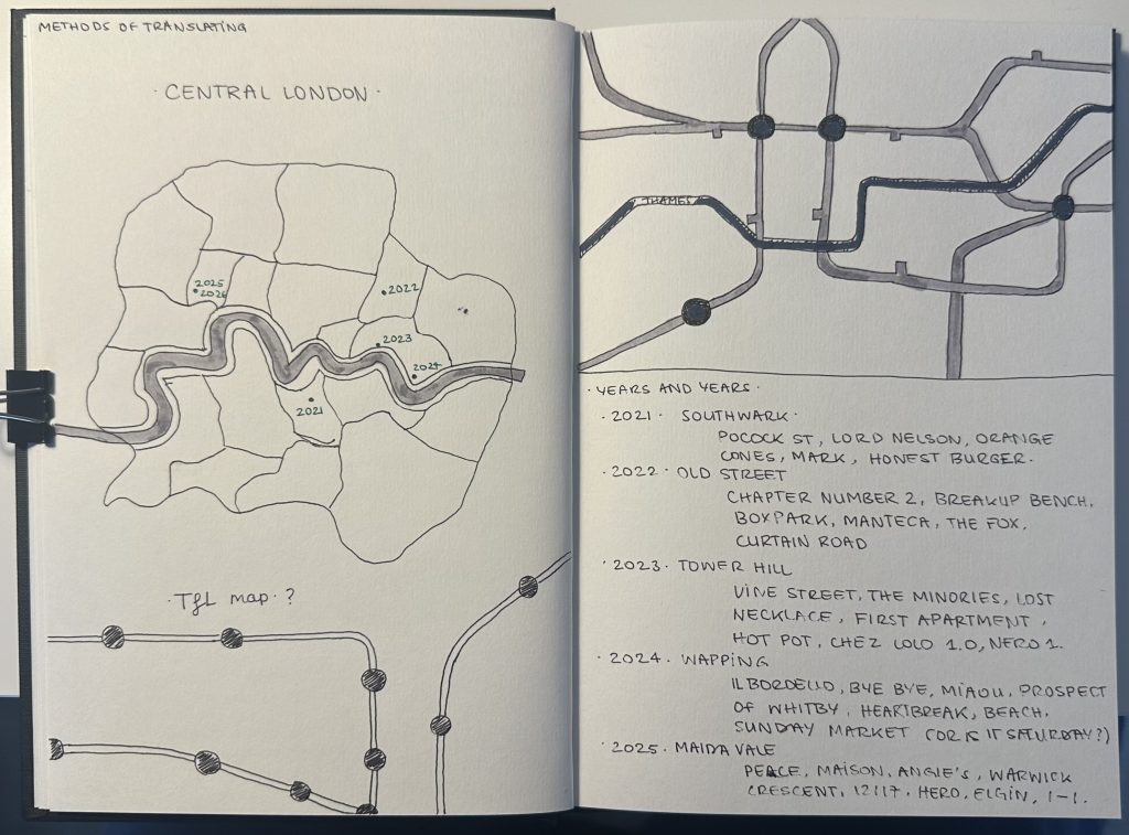
From there, the TfL map became my starting point. Rather than treating it as a fixed diagram, I approached it as a structure that could be hijacked and reinterpreted. The goal was to translate the map into a reflection of personal experience: highlighting specific stations, routes, and connections that shape how someone understands the city.
The first experiments involved altering the visual language of the map while keeping its recognisable structure. I explored different ways of emphasising personal routes, renaming locations, and shifting the hierarchy of information so that subjective experience could sit alongside the official network.
This process raised a broader question: if the TfL map simplifies London in order to communicate effectively, what happens when that system is used to communicate something more personal?
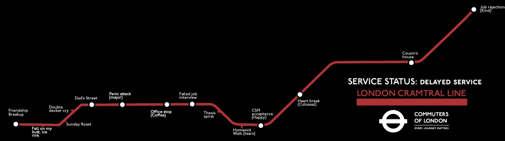
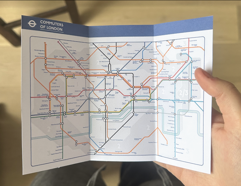
I first began by remapping the “Cramtral” line, before expanding the process to the entire map. I created a filled-out version that reflected my own associations and experiences, alongside a blank version intended to invite others to contribute their own. At this stage, the map existed simply as a single-sided printed format.
That’s all for week 1.
Leave a Reply